0 CHARLES GOODHUE MEM PK
Owner Information
CLANCY THOMAS P
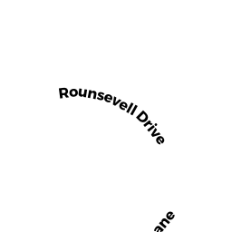
19-A ROUNSEVELL DR
EAST FREETOWN, MA 02717


Property Details
0 CHARLES GOODHUE MEM PK is classified as a Undevelopable Residential Land.
0 CHARLES GOODHUE MEM PK is valued at $54,100. The land is valued at $54,100 and the structures are valued at $0.
This property is in Zone R. Confirm with local Zoning Board authorities to ensure there are no overlays or other easements on this property.
The most recent deed for 0 CHARLES GOODHUE MEM PK is recorded at the local registrar in Book 10215, Page 58. 0 CHARLES GOODHUE MEM PK was last sold on Tuesday, August 25, 2020 for $1.
Assessment data from fiscal year 2022.
Flood Data
This property is partially within the A Zone (within floodplain). Approximately 3.06 acres (28.67%) of the property is within this zone.
This information is sourced from the FEMA National Flood Hazard Layer. See our full disclamer.
Broadband Internet Providers
| Provider | Type | Bandwidth (mbps) | |
|---|---|---|---|
| Verizon New England Inc. | DSL | 15 | 1 |
| Viasat Inc | Satellite | 100 | 3 |
| Verizon New England Inc. | Fiber | 940 | 880 |
| Comcast | Cable | 1000 | 35 |
| T-Mobile | Fixed Wireless | 25 | 3 |
| GCI Communication Corp. | Satellite | 0 | 0 |
| HughesNet | Satellite | 25 | 3 |
| VSAT Systems, LLC. | Satellite | 2 | 1 |
Broadband service provider data from December 2020.
Adjacent Properties
- 97 DR BRALEY RD
Single Family Residential owned by MAGNETT SWEDE M & AMY L - 35 ROUNSEVELL DR
Single Family Residential owned by VIEIRA JAMES B & JEAN H TRS - 33 ROUNSEVELL DR
Single Family Residential owned by LEMOI WATSON J & STOUT R & LAI - 31 ROUNSEVELL DR
Single Family Residential owned by JOSEFEK SHARON M L/E - 27 ROUNSEVELL DR
Single Family Residential owned by PELLERIN JASONP & SHERRELL L - 29 ROUNSEVELL DR
Single Family Residential owned by COTTER MICHAEL & SARAH - 25 ROUNSEVELL DR
Single Family Residential owned by PEREIRA JOSEPH - 21 ROUNSEVELL DR
Single Family Residential owned by OLIVEIRA JONATHAN J & ALICIA E - 19-A ROUNSEVELL DR
Single Family Residential owned by CLANCY THOMAS P & NANCI A - 0 DR BRALEY RD
Vacant, Other District (County) owned by NEW BEDFORD WATER DISTRICT